Safedigging can provide a range of aerial photographic survey and inspection services across a number of industries
Accurate survey data over large areas, delivered quickly with minimal interruption
- Stockpile Measurement
- Blast Volumes
- Progress Monitoring
- Topographic Surveys
- Cell Progress
- Compaction
- Blast Measurement
- Inventory Capture
Commercial - Industrial - Local Authority - Residential - Historic
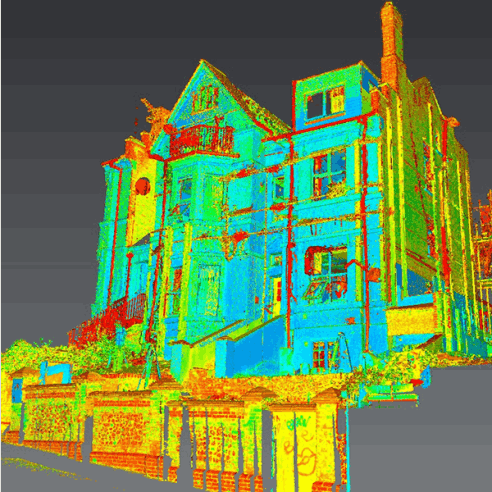
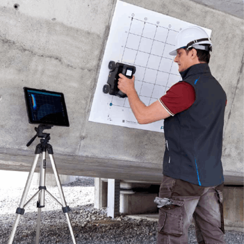
Aerial Topographical Surveys
Using aerial imagery, Safedigging can capture and process large-scale topographical surveys significantly quicker than conventional methods. Aerial surveys are also invaluable for sites where access is restricted due to safety considerations or continuing works which will otherwise be disrupted by the work of a ground surveyor.
Unlike many companies, our processing is generally done locally so that we can capture errors and optimise quality of outputs. Information security is also assured.
Surveys can be delivered in any industry standard format including:
- AutoCAD .dwg
- DXF geo-referenced mesh
- LAS/LAZ point cloud
Also see: Topographic Surveys
Asset Inspection
Using drone data, we capture high-resolution images, of your building, identify action points & capture measurements to construct and annotate a 3D model, viewable in a standard web browser.
Reports can then be generated to pass on to stakeholders & contractors.
Building & roof inspections usually require the structure to be cocooned in scaffolding after an intensive risk assessment. This is both time-consuming & expensive.
Regardless of how detailed a risk assessment is, working at height will always remain a headache for employers.
Safedigging want to change the mind-set - we can quickly carry out a detailed photographic survey, which saves time, is inexpensive and no-on need take a step off the ground.
Also see: 3D Scanning
Earthworks Analysis
Aerial analysis is an invaluable means of monitoring large-scale earthworks throughout the lifecycle of a project. Safedigging can provide both the survey and access to an analytics portal dedicated to your project offering:
• Instant measurements of distances, volumes & tonnage
• Comparison measurements against previous surveys
• Import of design specifications for quick identification of construction anomalies and progress against plans
• Customisation and scheduling of reports for company/contractor distribution
• Industry-standard output files compatible with all common design software
Progress Imagery
Repeat aerial video and stills capture enables our clients to document the life of their projects from start to finish for both for internal reference and communications with key stakeholders.
Extremely detailed aerial photographs can be taken at very close proximity to areas that may be considered a high risk concern to you the owner, council or concerned prospective investors.
We deliver either raw imagery or fully produced video content as required. Time-lapse options are also available.
Freephone: 0800 689 5315
FOLLOW US!